
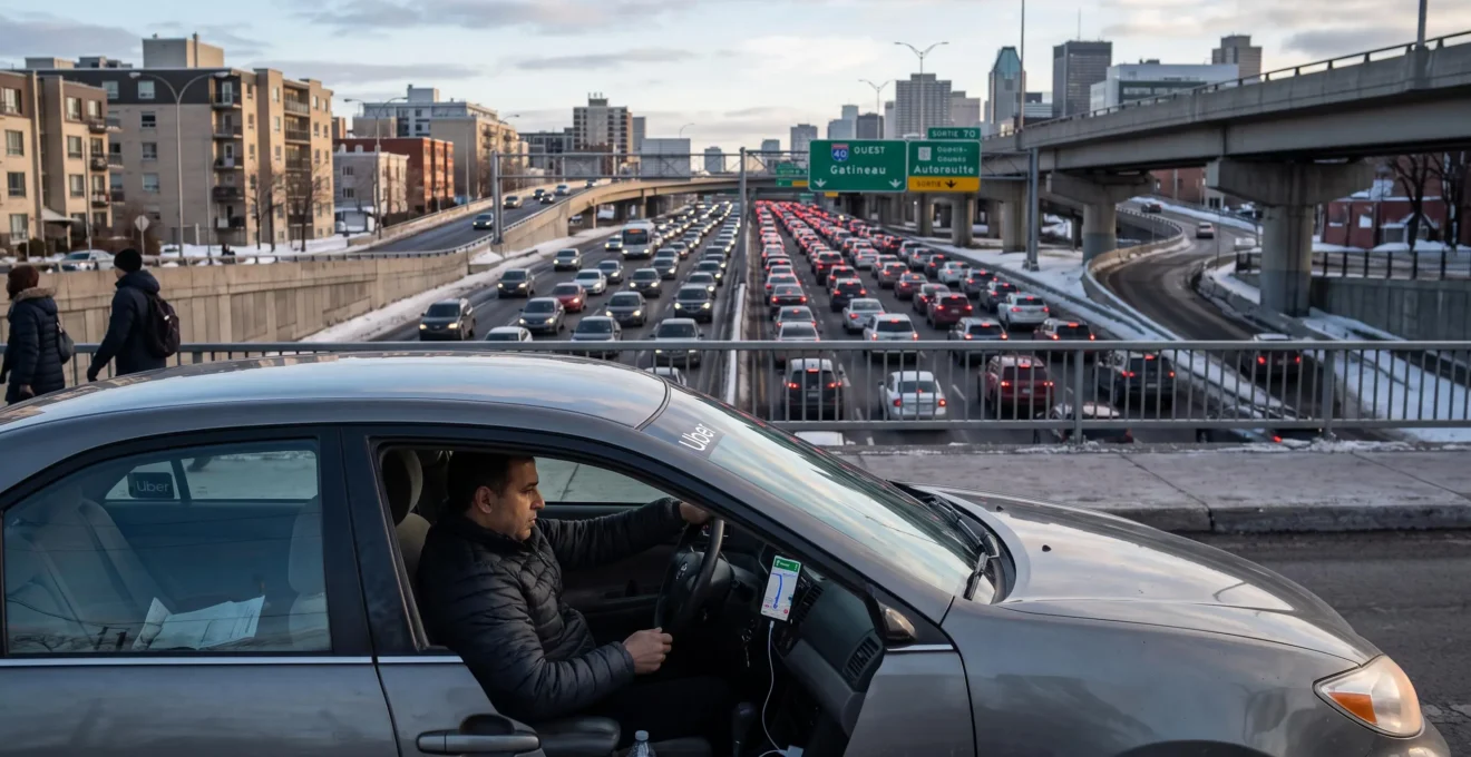
Montréal traffic can turn a routine cross-city journey into an unpredictable commute. A construction closure near the Turcot interchange, congestion on the Décarie Expressway or a poorly chosen pickup location may disrupt an otherwise reasonable itinerary. The shortest route on a navigation screen is not necessarily the fastest route when those conditions change.
Intelligent route optimization can reduce travel time by combining traffic predictions, current road restrictions, departure-time planning and local street knowledge. The 35% improvement in the headline is a potential scenario rather than a verified Montréal-wide result. Actual savings depend on the journey, traffic conditions and available alternatives.
The most useful approach is to treat GPS guidance as one source of information within a broader planning process. Official construction notices, live navigation estimates and practical knowledge of intersections or pickup points can help drivers make more reliable decisions, especially when delays matter more than distance.
Montréal route optimization: the essentials
- Combine live navigation estimates with municipal obstruction information and Québec 511 road alerts before travelling through construction-sensitive corridors.
- Compare complete journeys, including intersections, access ramps and destination approaches, rather than assuming that a highway or shortcut is always faster.
- Improve arrival-time reliability by testing departure windows, preparing a backup route and confirming a legal, accessible pickup location.
- Why Static GPS Routes Fail in Montréal: The Role of Live Construction Data in Route Selection
- How to Bypass Décarie, Ville-Marie, and Turcot: Alternative Routes That Can Save 20+ Minutes
- Highway 20 vs. Boulevard Saint-Laurent: Which Route Is Faster at 8 AM vs. 6 PM?
- The GPS Mistake That Adds 18 Minutes: Why Apps Miss Montréal’s Unofficial Shortcuts
- What Time to Leave: Avoiding Montréal’s Peak Windows Beyond 7–9 AM and 4–6 PM
- How Precise Pickup Instructions Eliminate the 15-Minute Driver Search That Delays a Large Share of Rides
- Why Your Shuttle Doesn’t Visit Stops in Geographic Order: The Route Optimization Logic Explained
- How to Navigate Montréal’s April–November Construction Season Without Adding 40 Minutes to Trips
Why Static GPS Routes Fail in Montréal: The Role of Live Construction Data in Route Selection
Static GPS directions can become unreliable when construction changes road access after a route has been calculated. Modern navigation applications already combine historical traffic patterns with live observations, but their recommendations still depend on the restrictions and conditions represented in their data. Checking official construction notices alongside a navigation app provides an additional safeguard against routing through an affected corridor.
The distinction is between a calculated route and a continuously reassessed journey. A route selected before departure may have been reasonable when calculated, yet an unexpected lane restriction, newly activated detour or intersection obstruction can alter its usefulness. The response should be to reassess the route using available information, not to assume the original estimate remains accurate.
According to Google Maps‘ explanation of traffic prediction and route selection, its system combines historical travel patterns, live traffic conditions, government-supplied road information and reports from navigation users. This makes modern GPS considerably more capable than a purely static map, although no navigation system guarantees immediate representation of every newly introduced restriction.
Montréal drivers can strengthen that information through two complementary official services:
- Municipal obstructions: the City of Montréal provides construction information derived from occupancy permit applications, covering work by municipal authorities, utilities and other parties within its service area.
- Provincial road conditions: Québec 511 provides regional road information, including construction hindrances, warnings and complete or partial closures.
- Navigation predictions: GPS applications estimate which available route may offer a better journey time, taking traffic behaviour and reported restrictions into account.
The distinction matters because the municipal service does not include construction administered by Québec’s provincial transportation ministry. A driver relying exclusively on the municipal map could therefore miss relevant restrictions affecting highways or interchanges.
The City of Montréal’s Obstructions and Construction Info service provides location-based access to municipal obstruction information and filters for affected areas or responsible organizations.
A useful morning routine begins by checking the roads most sensitive to closures, then comparing those restrictions with the route proposed by the navigation application. If a posted closure appears inconsistent with the suggested itinerary, inspect its dates, direction and precise location before choosing another route.
Diverting onto secondary streets is not automatically an improvement. Several drivers responding to the same disruption may concentrate traffic on a limited number of alternative roads, creating new queues at signals and intersections.
The objective is not to replace GPS technology with manual planning. It is to combine multiple information sources so that a route remains appropriate when road conditions change.
How to Bypass Décarie, Ville-Marie, and Turcot: Alternative Routes That Can Save 20+ Minutes
Bypassing Montréal’s Décarie, Ville-Marie and Turcot corridors requires choosing an alternative based on the destination, the affected connection and current traffic conditions. Parallel streets can sometimes avoid severe congestion, but they are not universally faster. Savings exceeding 20 minutes are possible in particular scenarios, yet the available sources do not establish a consistent benefit of that magnitude.
The Turcot interchange is best approached as a network of decisions involving Autoroute 20, Autoroute 15 and the downtown-oriented Autoroute 720 corridor. Each connection serves different directions, meaning that a closure affecting one movement does not necessarily justify avoiding the entire interchange.
Consider a driver approaching from the west. The appropriate decision depends on whether the final destination is downtown, in a neighbourhood south of the highway or farther north. The correct alternative may involve leaving the highway earlier, remaining on another available connection or choosing a surface-street approach near the destination.
Potential surface-road corridors include Côte-des-Neiges, Saint-Jacques and de la Vérendrye. These are route-planning candidates, not guaranteed detours: their usefulness depends on origin, destination, direction, current access and local restrictions.
Before selecting one, examine the full travel-time consequences.
| Travel condition | Highway option | Surface-street option |
|---|---|---|
| Normal traffic flow | May provide efficient longer-distance movement | May involve frequent signals and turning delays |
| Blocked highway connection | May require a significant upstream diversion | May provide an accessible alternative approach |
| Morning commuting period | Check direction-specific congestion and merging points | Check school-area activity and intersection queues |
| Midday commercial activity | Review current incident and construction conditions | Account for deliveries, stopping activity and turning movements |
| Evening commuting period | Check outbound congestion and interchange access | Consider traffic signals and neighbourhood restrictions |
A longer route can also be more predictable. If a highway journey has a low estimated travel time but exposes the driver to an unresolved incident, a slightly slower alternative with more available connections may be preferable for a time-critical appointment.
That choice involves two separate measures: expected travel time and travel-time variability. A route that usually takes less time may still be less dependable when a particular interchange frequently becomes difficult to access.
A practical comparison can be made over successive comparable commuting days. Record the journey time for the regular route and, when conditions allow, an alternative between the same origin and destination. Note the departure time, direction, unusual restrictions and actual arrival time.
These observations will not establish a universal 20-minute saving. They can, however, reveal whether a particular alternative regularly improves the driver’s own journey or only appears attractive during exceptional incidents.
A good detour avoids the relevant restriction without transferring the same delay to a series of local intersections. The next decision is whether the highway or the urban street network provides the more reliable complete journey.
Highway 20 vs. Boulevard Saint-Laurent: Which Route Is Faster at 8 AM vs. 6 PM?
Neither Highway 20 nor Boulevard Saint-Laurent is consistently faster at 8 AM or 6 PM. The answer depends on the origin, destination, travel direction, highway access and current congestion. These roads also serve different parts of Montréal, so they are not interchangeable alternatives for every journey. A meaningful comparison must use the same starting point and destination.
Highway 20 supports longer-distance travel and connections across important parts of the metropolitan road network. Boulevard Saint-Laurent is an urban arterial with intersections, pedestrian activity, turning movements and access to surrounding neighbourhoods.
Higher permitted speeds do not guarantee faster door-to-door travel. Time spent accessing an interchange, waiting at an intersection or approaching the final destination can offset an advantage gained on a faster-moving road segment.
The direction of travel introduces another important variable. Commuting demand can concentrate toward major employment areas in the morning and shift toward residential destinations later in the day. Actual congestion patterns nevertheless vary by corridor and should be verified rather than assumed for every trip.
| Comparison factor | 8 AM journey | 6 PM journey |
|---|---|---|
| Highway 20 | Check morning traffic in the relevant direction and access-ramp restrictions | Check evening congestion, incidents and the destination-side exit |
| Boulevard Saint-Laurent | Account for intersections, local commuting demand and possible stopping activity | Account for signals, pedestrian movements and urban destination access |
| Longer journey | Compare the complete highway itinerary against available alternatives | Recalculate using current conditions rather than morning assumptions |
| Short urban journey | Consider whether highway access creates an unnecessary detour | Check whether a direct surface-road route avoids difficult ramps |
| Unexpected incident | Assess where an affected route can be exited safely and legally | Compare remaining delay with the cost of changing routes |
Distance provides a useful first filter, not a definitive rule. Longer journeys may benefit from high-capacity roads, whereas shorter trips can lose that advantage through additional access movements.
For example, in a hypothetical commute where the destination is directly accessible from Saint-Laurent, a highway itinerary may involve additional kilometres and an inconvenient exit. Conversely, an origin and destination connected efficiently by Highway 20 may make the urban alternative unnecessarily slow.
A second consideration is recoverability. When an incident blocks an important highway connection, exiting or changing direction may be difficult until the next available junction. Urban streets can sometimes offer more route choices, although their intersections and restrictions also limit flexibility.
For a dependable comparison, save both complete itineraries and assess their predicted arrival times shortly before departure. Repeat that assessment when the travel direction or time changes.
Choosing the appropriate road category is only the first step. Navigation accuracy also depends on whether smaller connections and local restrictions are represented correctly.
The GPS Mistake That Adds 18 Minutes: Why Apps Miss Montréal’s Unofficial Shortcuts
A navigation application can overlook a useful local connection when mapping information, access restrictions or expected delays do not accurately reflect current conditions. However, a road absent from a suggested itinerary is not necessarily a better shortcut. The claim that such mistakes add 18 minutes is not supported by a Montréal-specific measurement in the supplied evidence and should be treated as scenario-dependent.
Routing systems evaluate available connections according to their road-network information and estimated travel costs. Their decisions may account for live traffic, road characteristics and reported restrictions, yet the practical suitability of smaller streets can still require verification.
Some possible shortcuts are unsuitable because they involve:
- One-way streets or turn restrictions that make the proposed movement illegal.
- Alleys or private access routes that are not intended for through traffic.
- School areas, pedestrian-sensitive streets or restricted access points.
- Intersections where turning queues offset a shorter distance.
- Temporary construction restrictions that alter an otherwise familiar connection.
These limitations make it important to distinguish a legitimate alternative route from an improvised manoeuvre that is prohibited, unsafe or disruptive to neighbourhood traffic.
An experienced driver may know that a particular intersection is difficult during certain periods or that approaching a destination from another direction avoids an awkward turn. Such knowledge can improve route selection, but its usefulness changes as traffic patterns, restrictions and construction schedules change.
Local knowledge is also less exclusive than it may appear. When many drivers discover and use the same alternative, congestion can increase on that street. A shortcut that once reduced journey times may eventually become comparable to, or slower than, the principal corridor.
Consider a hypothetical driver who normally uses an arterial route but knows a legal parallel street near the destination. On a day when the arterial is obstructed, the alternative might avoid the queue. On another day, repeated traffic lights and additional turns could eliminate the benefit.
The correct evaluation therefore includes more than distance. Check current legal access, turning restrictions, intersection conditions and the estimated time required to rejoin the intended route.
A practical habit is to review familiar shortcuts periodically instead of treating them as permanent solutions. Compare their actual journey times across comparable conditions and discontinue using those that no longer offer a reliable advantage.
Even the best available shortcut may offer little benefit when the entire corridor is saturated. Adjusting the departure time can sometimes be more effective than changing the roads used.
What Time to Leave: Avoiding Montréal’s Peak Windows Beyond 7–9 AM and 4–6 PM
The most effective departure time is the one that provides an acceptable arrival time with the lowest risk of delay, not necessarily the one with the shortest average trip. Montréal’s commonly discussed morning and evening peak periods are useful planning references, but midday activity, Friday travel and construction can produce additional congestion. Comparing several departure windows reveals what works for a specific journey.
Traffic congestion often develops in phases rather than appearing instantly at the beginning of a nominal rush-hour period.
- Pre-peak: traffic demand builds, and some routes remain relatively predictable.
- Peak saturation: queues, merging delays and restricted intersection capacity can produce more variable travel times.
- Post-peak recovery: demand eases, but residual congestion or road incidents may continue affecting a corridor.
Moving departure time slightly may change the traffic conditions experienced across the entire trip. Leaving earlier can allow a driver to pass a congested interchange before queues develop, while leaving later may mean arriving after congestion has diminished.
The relationship is not linear. Departing 20 minutes earlier does not necessarily mean arriving exactly 20 minutes earlier. Actual arrival depends on how journey duration changes during that interval.
Midday travel deserves separate attention, especially for routes crossing commercial districts or areas with significant local activity. Friday afternoon and evening patterns can also differ from those observed earlier in the working week.
Rather than adopting a generic recommendation, build a personal departure-time comparison over two weeks. Select three realistic candidate windows and record actual travel times whenever comparable journeys are available.
| Departure window | What to record | Decision criterion |
|---|---|---|
| Earlier than usual | Actual journey duration and exceptional conditions | Does the earlier departure meaningfully improve arrival reliability? |
| Usual departure | Actual journey duration and observed delays | How predictable is the current routine? |
| Later than usual | Actual journey duration and remaining congestion | Does waiting reduce delays without missing the required arrival time? |
The lowest average duration may not be the most suitable option for an appointment that cannot begin late. Examine the spread between faster and slower observations as well as typical journey time.
Five steps to establish a more reliable Montréal departure plan
- Define the journey: save the exact origin, destination and required arrival time as a reusable route reference.
- Select three departure windows: write down an earlier, usual and later time that can realistically fit the schedule.
- Record actual journeys: create a two-week log showing departure, arrival, route and unusual traffic conditions.
- Compare reliability: summarize the typical duration and range of observed journey times for each window.
- Choose a primary and backup plan: document the preferred departure window and an alternative to use when current restrictions change the expected journey.
This procedure is a personal measurement method, not a published Montréal traffic study. Its findings apply to the observed route and conditions rather than to all commuters.
If many travellers shift toward the same alternative departure period, that period can also become more congested. Departure optimization should consequently be reviewed as travel patterns change.
A carefully selected departure time becomes more valuable when the journey begins promptly. For taxis, rideshares and shuttles, an unclear pickup location can undermine that advantage before the vehicle even starts moving.
How Precise Pickup Instructions Eliminate the 15-Minute Driver Search That Delays a Large Share of Rides
Precise pickup instructions reduce uncertainty by identifying where a driver can actually stop, rather than relying entirely on the passenger’s approximate GPS position. A recognizable building entrance, legal curbside location or designated transportation pickup area can make coordination easier. The proposed 15-minute reduction is not a verified average, but preventing avoidable searches can protect both departure time and arrival reliability.
A passenger’s location and an appropriate vehicle stopping point are not always identical. A phone may indicate a position inside a large building, on the wrong side of a divided street or near an entrance where stopping is restricted.
The routing application can bring the driver close to the passenger without resolving that final physical connection.
Different Montréal environments create different pickup challenges.
| Location | Common ambiguity | Useful instruction |
|---|---|---|
| Dense downtown street | Multiple entrances or stopping restrictions | Specify the building entrance and a permitted pickup point |
| Residential neighbourhood | Street numbering, one-way circulation or opposite-side arrival | Confirm the civic number, street side and accessible approach |
| Airport or transportation station | Several terminals, exits or designated vehicle zones | Use the appropriate officially designated pickup area and its current instructions |
A helpful message names a stable landmark that is unlikely to change while the driver approaches. Building doors, identifiable intersections and designated pickup zones are generally easier to interpret than descriptions such as “near the busy corner” or “beside the parked vehicles.”
For example, a passenger might state: “Pickup at the main entrance on the north side of the building. I will be waiting at the permitted passenger pickup point.” The message should be adapted to the actual site and should never direct a driver to stop illegally.
Where a location has a dedicated taxi, shuttle or rideshare area, the applicable facility instructions should take priority over a passenger-selected map pin.
Pickup delays can also have downstream effects. In a hypothetical journey scheduled just before heavier congestion, a late departure might expose the vehicle to queues that an on-time departure could have avoided. The resulting journey delay could therefore exceed the time spent searching for the passenger.
The most effective procedure is to confirm the location before the vehicle arrives, ensure the passenger can reach it and communicate any changes clearly. For group transportation, the organizer should establish one unambiguous boarding point whenever practical.
Precise pickup locations become especially important when several passengers share a vehicle. Their combined schedules introduce a different optimization challenge: deciding which stop should come first.
Why Your Shuttle Doesn’t Visit Stops in Geographic Order: The Route Optimization Logic Explained
A shared shuttle does not necessarily visit the nearest passenger first because route optimization considers more than geographic distance. Pickup windows, drop-off deadlines, road restrictions, travel direction and vehicle capacity can change the best stop sequence. An apparently indirect route may satisfy those constraints more effectively than a simple nearest-to-farthest itinerary, although it is not automatically optimal.
Multi-stop transportation belongs to a class of routing problems in which a vehicle must serve several locations while respecting operational requirements. A familiar mathematical reference is the travelling salesperson problem, but shuttle planning often requires additional constraints that make the decision more complex.
With ten distinct stops, there are 3,628,800 possible orders if every permutation is considered. This is a mathematical count, not a claim that every sequence is legally accessible or operationally feasible. Time windows, vehicle capacity and travel restrictions eliminate many potential arrangements.
The SIAM chapter on vehicle routing with time windows explains how service schedules influence route feasibility. Some models require service to begin within a strict time window, while others allow deviations with an associated penalty.
This distinction helps explain why a shuttle might pass close to one passenger’s destination before completing another scheduled stop.
Consider a hypothetical shuttle with three passengers. The nearest destination may permit arrival at any time, while another passenger has a defined appointment deadline. Serving the second destination first could prevent a missed arrival window without necessarily increasing the overall operating cost.
Other factors can include the direction in which a vehicle can legally approach a pickup point and whether a particular turn or connection is available.
Shared and private transport also have different optimization objectives. A shared service may seek to balance multiple passengers’ travel times, pickup commitments and operational constraints. A private vehicle usually focuses on the itinerary of one booking, although road restrictions and scheduling commitments still apply.
Passengers can assess the service by looking for recurring problems rather than judging an isolated stop sequence. Consistently missed appointment windows, unexplained excessive detours or repeated failures to reach feasible pickup locations warrant questions about the operator’s routing decisions.
Being dropped off last is not by itself proof of inefficient planning. A route may reflect other passengers’ deadlines, operating constraints or the position of the vehicle’s next assignment. The provider should nevertheless be able to explain the relevant scheduling principle.
Route optimization is therefore a balance between mathematical efficiency and service quality. A technically short itinerary may be unsuitable if it leaves passengers with unacceptable or unpredictable delays.
The same principle extends to citywide travel planning: the best itinerary is not simply the shortest line between locations. It is the one that remains feasible under real operating conditions, particularly when construction changes those conditions.
Key decisions before your next trip
- Separate a full road closure from a lane restriction or a warning before abandoning an established route.
- Prepare alternative corridors in advance, but check their current legality, accessibility and expected travel time.
- Revalidate established commuting and shuttle routes when seasonal construction changes road access or traffic patterns.
How to Navigate Montréal’s April–November Construction Season Without Adding 40 Minutes to Trips
Navigating Montréal’s construction season requires checking the type, location and timing of planned road restrictions before departure. The April–November period is a useful seasonal planning framework, not a guarantee that work begins or ends on fixed dates. Reviewing official notices and preparing suitable alternatives can reduce exposure to avoidable delays, although no universal 40-minute saving has been established.
Construction projects affect journeys in different ways depending on the restrictions applied. Some works involve complete closures, while others reduce available lanes, change turning movements or introduce temporary traffic controls.
The severity of a restriction cannot be determined from the presence of construction alone. A partial obstruction during a quieter travel period may have a different effect from a complete ramp closure during a busy commuting window.
Montréal’s municipal construction information and provincial road information complement each other, but neither source establishes a fixed delay for every reported restriction.
The Québec 511 interactive road-information map distinguishes complete and partial closures, as well as major and minor roadwork hindrances. This allows drivers to identify the reported restriction rather than treating all construction notices as equivalent.
| Reported restriction | Planning response | Important verification |
|---|---|---|
| Complete closure | Identify a legally accessible alternative that avoids the closed connection | Confirm direction, affected segment and applicable dates |
| Partial closure | Compare the reduced-capacity route with available alternatives | Check remaining lanes and current congestion |
| Major roadwork hindrance | Review expected exposure and plan additional flexibility | Check whether access remains possible |
| Minor roadwork hindrance | Assess whether the normal itinerary remains practical | Avoid assuming that a complete detour is required |
| Scheduled nighttime or weekend closure | Adapt the departure time or route for the affected period | Confirm the notice is applicable to the planned journey |
A weekly planning routine can reduce last-minute decisions. Identify two or three construction locations that could affect the roads used regularly, examine the announced restriction periods and save alternative itineraries for each relevant destination.
The objective is not to memorize every construction project in Montréal. It is to recognize which disruptions intersect the individual’s usual transport network.
Construction schedules also require ongoing verification. Weather, technical complications and project adjustments may change the restrictions that were originally expected. A route prepared in spring should not be assumed to remain appropriate throughout autumn.
For example, a hypothetical commuter may identify a scheduled closure affecting a usual highway connection and prepare a surface-road alternative. Before the actual departure, checking whether that closure is active prevents unnecessary use of the detour when the normal connection remains available.
The same approach applies to professional drivers, frequent travellers and shuttle coordinators. Local experience helps identify plausible alternatives, while current road data indicates whether those alternatives remain usable.
Ultimately, technology is most valuable when paired with a repeatable decision process: verify the restriction, compare complete itineraries, choose an appropriate departure window and reassess the route if conditions change.
For your next Montréal trip, save the origin and destination, check the relevant construction notices, compare a primary route with one legal alternative and record the actual journey time. Repeating this process provides a practical basis for improving future travel decisions without depending on unsupported percentage-saving promises.
Can route optimization really reduce Montréal travel time by 35%?
A 35% reduction may be achievable in a particular journey where a significantly better route or departure time is available, but the supplied sources do not establish this as an average or guaranteed result. The improvement must be calculated by comparing actual travel times for equivalent journeys under documented conditions.
Should drivers always follow the fastest route shown by their GPS?
No. A navigation estimate is a useful prediction, but drivers should also consider reported closures, road access, legal restrictions and the predictability of alternative routes. Official municipal and provincial road information can help verify whether a proposed journey remains feasible.
How can a commuter measure whether a route change actually saves time?
Record departure and arrival times for the same origin and destination over comparable journeys. Note the day, direction, road restrictions and route used. Compare both typical journey duration and variation between observations. A single unusually fast trip is not sufficient to establish a dependable advantage.
Does an experienced Montréal driver always outperform a navigation app?
No universal advantage has been demonstrated by the supplied evidence. Experienced drivers may contribute useful knowledge about access points, local intersections and changing construction patterns. Modern navigation applications contribute traffic observations and predictions. Combining the two may be useful, but actual performance depends on the journey and must be measured.
How frequently should a regular Montréal commuting route be reassessed?
Review the route whenever major construction, recurring congestion or a change in travel schedule affects the journey. A brief check before departure is particularly useful for construction-sensitive corridors, while periodic comparisons of actual travel times can help determine whether an established alternative remains worthwhile.